

 Facebook
 X
X
 Pinterest
 Copy Link
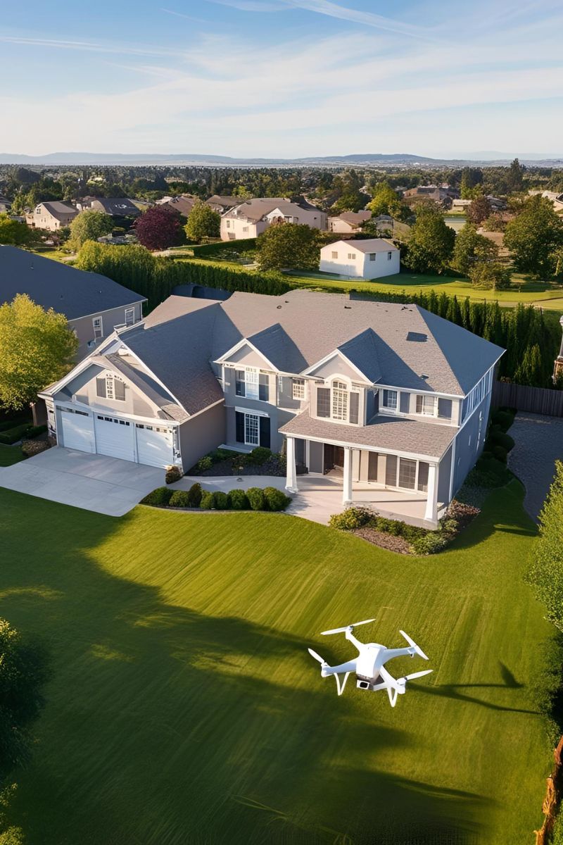
Technology shapes how properties are marketed and sold in the ever-evolving real estate industry. One of the most impactful advancements in recent years is aerial photography. The ability to capture stunning, high-resolution images from above has revolutionized the way real estate agents list land and lots, offering a new level of perspective and detail that traditional ground-level photos simply cannot match. Here’s how aerial photography is changing the game for real estate professionals and their clients.
1. Enhanced Property Visualization
Aerial photography provides potential buyers with a clear, comprehensive view of the land. Unlike traditional photos that can only showcase specific angles and limited perspectives, aerial images highlight the full scope of the property. This is especially useful for large plots of land, rural properties, or lots with unique geographical features. Buyers can immediately grasp the property’s boundaries, topography, and overall layout, helping them make more informed decisions.
2. Showcasing Surrounding Areas
Location is a crucial factor in real estate. Aerial photography allows agents to showcase not only the property itself but also its surroundings. Whether it’s proximity to key landmarks, nearby developments, road access, or natural features like lakes and forests, aerial images provide valuable context. This is particularly useful for buyers who may not be familiar with the area and want a broader view of what they’re purchasing.
3. Highlighting Property Features and Potential
Aerial shots offer a bird’s-eye view of a lot’s potential uses. For example, investors or developers can better assess how a piece of land can be subdivided, where structures could be placed, or how roads and utilities could be integrated. This perspective is invaluable when selling vacant lots or land with development potential, as it helps buyers visualize opportunities that might not be apparent from the ground.
4. Increasing Buyer Engagement and Interest
High-quality aerial photography makes a listing stand out in an increasingly competitive market. Listings with aerial imagery tend to receive more views, clicks, and inquiries compared to those with standard ground-level photos. This added level of detail and professionalism can create a stronger emotional connection with potential buyers, leading to faster sales and potentially higher offers.
5. Improving Accuracy in Marketing Materials
Inaccurate or misleading property descriptions can lead to buyer frustration and wasted time. Aerial photography provides a true representation of a lot’s size, shape, and condition, reducing misunderstandings. It also enhances marketing materials such as brochures, websites, and online listings, making them more visually appealing and informative.
6. Competitive Edge for Real Estate Agents
Incorporating aerial photography into listings is becoming a standard practice among top-tier real estate agents. Those who leverage this technology gain a competitive edge by offering a more professional, detailed, and immersive experience for buyers. Drone photography and videography, in particular, add an extra layer of engagement and provide dynamic visual storytelling that static images cannot achieve.
Conclusion
Aerial photography has fundamentally changed the way real estate agents market land and lots. By providing enhanced visualization, showcasing surroundings, highlighting property features, increasing engagement, improving marketing accuracy, and giving agents a competitive advantage, this technology has become an indispensable tool in modern real estate. For agents looking to elevate their listings and attract more buyers, investing in aerial photography is no longer optional—it’s essential.


